Entwine
Exercise
This exercise uses PDAL to fetch data from an Entwine index stored in an Amazon Web Services object store (bucket). Entwine is a point cloud indexing strategy, which rearranges points into a lossless octree structure known as EPT, for Entwine Point Tiles. The structure is described here: https://entwine.io/entwine-point-tile.html.
EPT indexes can be used for visualization as well as analysis and data manipulation at any scale.
Examples of Entwine usage can be found from very fine photogrammetric surveys to continental scale lidar management.
US Geological Survey (USGS) example data is here: https://usgs.entwine.io/
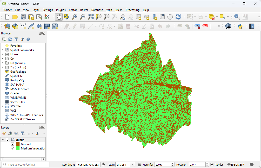
We will use a sample data set from Dublin, Ireland https://viewer.copc.io/?r=https://na-c.entwine.io/dublin/ept.json
The JSON file defines the pipeline which you were previously creating in jq. This simplifies the task and allows for easy repetition of tasks. This pipeline will collect the sample data set and convert it to a COPC file.
View the
./exercises/translation/entwine.jsonfile in your editor.{ "pipeline": [ { "type": "readers.ept", "filename":"https://na-c.entwine.io/dublin/ept.json", "resolution": 5 }, { "type": "writers.copc", "filename": "dublin.copc.laz", "forward": "all" } ] }
Note
If you use the Developer Console when visiting http://speck.ly or http://potree.entwine.io, you can see the browser making requests against the EPT resource at http://na-c.entwine.io/dublin/ept.json
Issue the following command in your Conda Shell.
$ pdal pipeline ./exercises/translation/entwine.json -v 7
(PDAL Debug) Debugging...
(pdal pipeline readers.ept Debug) Root resolution: 21.3828
Query resolution:  5
Actual resolution: 2.67285
Depth end: 4
Query bounds: ()
Threads: 15
(pdal pipeline Debug) Executing pipeline in stream mode.
(pdal pipeline writers.las Debug) Wrote 8034506 points to the LAS file
Verify that the COPC data look ok:
$ pdal info dublin.copc.laz | jq .stats.bbox.native.bbox
{
    "maxx": -694128.96,
    "maxy": 7049938.84,
    "maxz": 385.37,
    "minx": -699477.88,
    "miny": 7044490.98,
    "minz": -144.24
}
$ pdal info dublin.copc.laz -p 0
{
    "file_size": 90310030,
    "filename": "dublin.copc.laz",
    "now": "2023-06-02T13:40:36-0500",
    "pdal_version": "2.5.3 (git-version: Release)",
    "points":
    {
      "point":
      {
        "ClassFlags": 0,
        "Classification": 2,
        "EdgeOfFlightLine": 0,
        "GpsTime": 402930.3873,
        "Intensity": 220,
        "NumberOfReturns": 1,
        "OriginId": 0,
        "PointId": 0,
        "PointSourceId": 34,
        "ReturnNumber": 1,
        "ScanAngleRank": 22.99799919,
        "ScanChannel": 0,
        "ScanDirectionFlag": 1,
        "UserData": 0,
        "X": -695085.89,
        "Y": 7048577.02,
        "Z": 7.8
        }
    },
    "reader": "readers.las"
}
Visualize the data in QGIS
Note
QGIS also supports uploading Entwine data directly from the cloud. Under ‘Layer -> Add Layer -> Add Point Cloud Layer’, select the source type as “Protocol: HTTP(S), cloud, etc.” and insert the URL of an EPT index.
Notes
readers.ept contains more detailed documentation about how to use PDAL’s EPT reader.